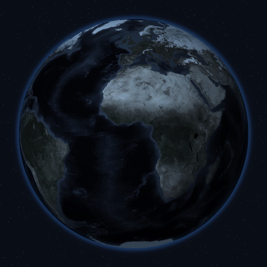
One live globe
Earthquakes, conflict, disasters and cyber events on a single 3D globe, clustered by category and severity. Filter any layer on or off.
Earthquakes, conflict, disasters and cyber threats on one map — every event traced back to the institution that published it, from 13 official sources.
WorldPulse is a global event monitoring app for iOS and Android that brings earthquakes, armed conflict, natural disasters, cyber threats and world news onto a single live map — aggregating 13 official data sources and linking every event back to the institution that published it.
We don't write the news. We read official feeds, normalise them into one event model and put them on the map — with the origin one tap away.
Earthquakes, conflict, disasters and cyber events on a single 3D globe, clustered by category and severity. Filter any layer on or off.
USGS, NOAA, NASA, GDACS, CISA, NIST, Smithsonian and more. Every event links straight back to the agency that published it.
Add your family's city, a business trip or a holiday route. Get alerted only when something crosses your chosen severity near them.
A severity-weighted summary of the last 24 hours against a 7-day baseline, with hourly trend and per-category spikes.
Nuclear plants, dams, ports, airports, data centres, military bases and maritime chokepoints, from OpenStreetMap.
Critical, High or All — plus Quiet Hours. Defaults start narrow deliberately, because a noisy alert app gets deleted.
Follow a developing event in the Dynamic Island and on your lock screen while it unfolds.
Home screen and lock screen widgets showing the Activity Index and the latest significant events.
English, Turkish, German, French, Spanish, Italian, Portuguese (BR) and Arabic.
Scheduled jobs poll 13 official sources and 10 news feeds every 5 to 15 minutes — government APIs, GeoJSON feeds, GeoRSS and raw event exports.
Every record is converted into one event model: category, subtype, severity 1–5, coordinates, timestamp and source. Duplicates across sources are merged by proximity, time window and title similarity.
Events are drawn on the map and pushed to your watch locations — but only above the severity you chose, and never during your Quiet Hours.
Other apps in this category say their sources are "verified" or "trusted" without naming one. Here is the full list, with the official page for each.
Earthquake Hazards Program — GeoJSON summary feed
Global Disaster Alert and Coordination System — GeoRSS feed
Active Alerts API
EONET v3 (Earth Observatory Natural Event Tracker)
FIRMS active fire data (VIIRS S-NPP near real-time)
Global Volcanism Program — Weekly Volcanic Activity Report
DONKI (Space Weather Database Of Notifications, Knowledge, Information)
Space weather alerts and scales
GDELT 2.0 raw Event export (CSV)
Known Exploited Vulnerabilities (KEV) Catalog
National Vulnerability Database (NVD)
ThreatFox — indicators of compromise (IOC) API
Overpass API (ODbL-licensed open map data)
Real screens from WorldPulse on iPhone.
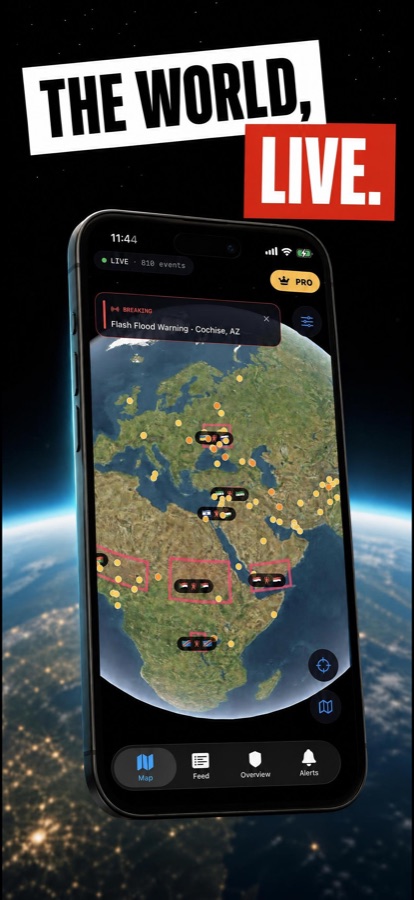
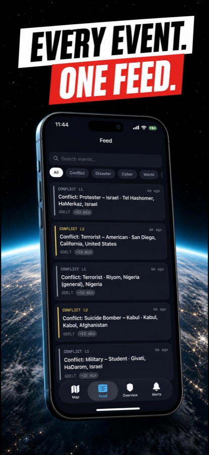
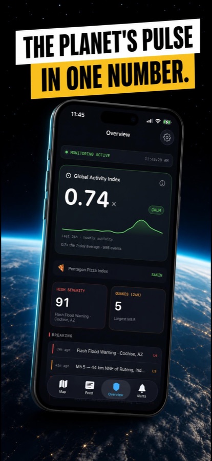
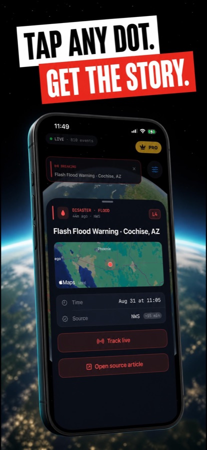
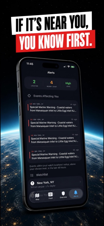
Some instruments are tied to specific places. Here they are, next to what is actually happening in those places right now.
144.91
Hürmüz BoğazıBab-el-MendebSüveyş Kanalı
6nearby events
4,169
Rusya–Ukrayna Savaşıİsrail–Gazze SavaşıSuriye İç Savaşı
6nearby events
510.12
Rusya–Ukrayna Savaşıİsrail–Gazze SavaşıYemen İç Savaşı
6nearby events
Most apps in this category call themselves real-time. Almost none are. WorldPulse polls its sources every 5 to 15 minutes and labels every event with how fresh it is. No invented threat levels, no fake gauges, no intelligence theatre — and no claim to track things we do not actually track.
Watch the city where your family lives and hear about it before the news cycle does.
Check conditions at your destination, and keep watching it while you're there.
Located events with named sources and timestamps, ready to verify.
Ports, chokepoints and border crossings on the same map as the disruptions.
Traceable data from USGS, NASA, NOAA and GDELT, each linked to its origin.
A calmer way to follow the world than an endless scroll of headlines.
WorldPulse is a global event monitoring app for iOS and Android that brings earthquakes, armed conflict, natural disasters, cyber threats and world news onto a single live map. It aggregates 13 official data sources — including USGS, NOAA, NASA, GDACS and CISA — plus 10 news feeds, and links every event back to the institution that published it.
Yes. The live map, the event feed and basic alerts are free, and no account is required to start. An optional Pro subscription adds unlimited watch locations, strategic infrastructure layers and advanced alerting.
All event data comes from publicly available official feeds: USGS for earthquakes, NOAA/NWS for severe weather, NASA EONET and FIRMS for natural events and fires, GDACS for global disaster alerts, CISA KEV and NIST NVD for cyber vulnerabilities, the Smithsonian Global Volcanism Program for volcanic activity, GDELT for conflict events, and OpenStreetMap for infrastructure. Every source is named and linked on our data sources page.
Every 5 to 15 minutes, depending on the source. We do not describe WorldPulse as real-time, because polling at that interval is not real-time. Each event carries a freshness label so you always know how recent it is.
No. WorldPulse is an independent application. It is not affiliated with, endorsed by, or representing USGS, NOAA, NASA, CISA, the United Nations or any other government or intergovernmental agency. For official warnings and emergency instructions, always consult your local authorities.
English, Turkish, German, French, Spanish, Italian, Portuguese (Brazil) and Arabic, with full right-to-left support.
iPhone and iPad running iOS 17.0 or later via the App Store, and Android phones and tablets via Google Play.
A news app gives you headlines. WorldPulse gives you located events: every item has coordinates, a severity level from 1 to 5, a named source and a timestamp, drawn on a map you can filter by category. You can also watch specific places and be alerted only when something happens near them.
Download WorldPulse free on iOS and Android.